
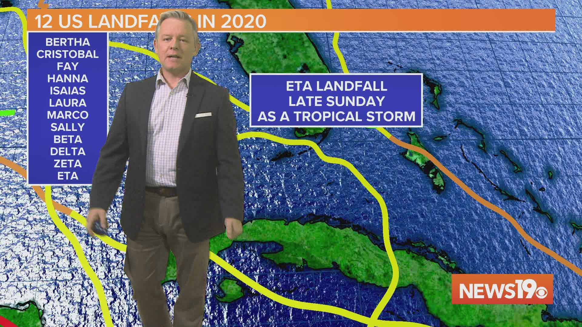
Tropical Storm Eta made landfall late Sunday night. It was the 12th named storm to make a United States landfall this season.
According to the National Hurricane Center, Eta made landfall in Lower Matecumbe Key at 11 pm on Sunday with maximum winds of 65 mph.
Before the 2020 Atlantic hurricane season, the most named storms to make landfall in the continental US in a single season was nine set in 1916.
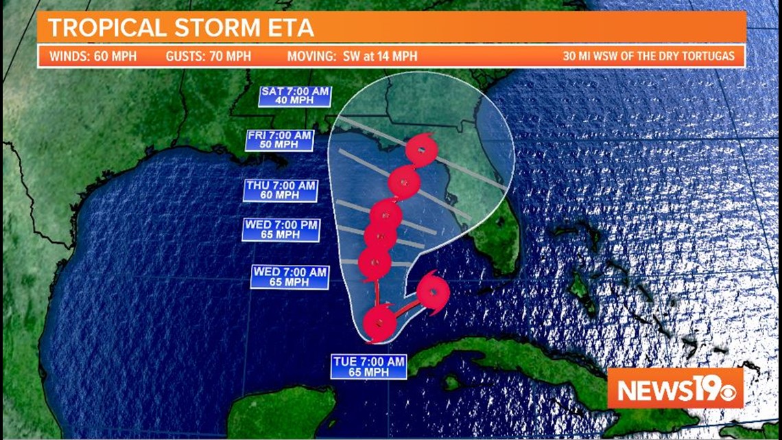
Late Monday morning, the storm was about 210 miles north-northeast of the western tip of Cuba. It had winds of 60 mph. Eta was moving southwest at 14 mph.
A tropical storm warning remained in effect for Dry Tortugas. Tropical storm watches were in effect for parts of Cuba.
The storm is forecast to meander in the Gulf of Mexico over the next several days.

Heavy rainfall from Eta will continue across portions of Cuba, the Bahamas, and southern and central Florida.
Life-threatening flash flooding will be possible across urban areas of southeast Florida today.
Flash and urban flooding will also be possible for Cuba, the Bahamas and the remainder of southern Florida, along with potential minor river flooding in central Florida.
RELATED: Local Forecast

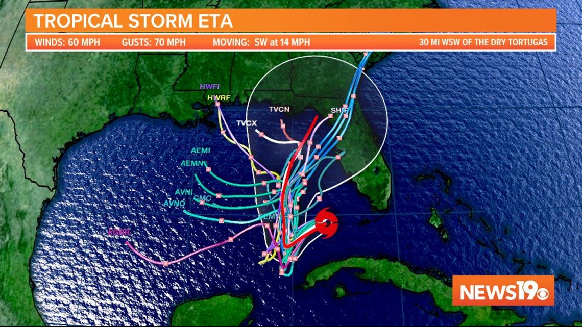
Interests along the Gulf Coast of Florida should monitor the progress of Eta.
Elsewhere in the Atlantic:
A tropical wave is forecast to move over the central Caribbean Sea, where an area of low pressure could form in a couple of days.
Conditions are forecast to be better for development, and a tropical depression could form late this week or over the weekend while the system moves slowly westward.
The NHC gives this area a 50% of further development over the next five days.
Another area being watched is located several hundred miles southwest of the Azores.
Further development is expected, and a tropical or subtropical storm will likely form during the next few days while the system moves eastward.
The NHC gives this area a 70% of further development over the next five days.
Neither one of this systems will impact the United States over the next five days. If either one becomes a named storm, that will set the record in the Atlantic for named storms in a season.