COLUMBIA, S.C. — Tornadoes developed in the east-central region of Georgia Friday afternoon. These storms were moving northeast towards the Midlands. A tornado watch was in effect for parts of the area.
The watch included Aiken and Saluda counties. The tornado watch was allowed to expire at 8 PM.
Severe weather is possible across the area tonight as a warm front in the southern Midlands slowly lifts northward.
The Midlands is under a marginal risk for severe weather according to the Storm Prediction Center. The greatest threat will be damaging wind gusts.
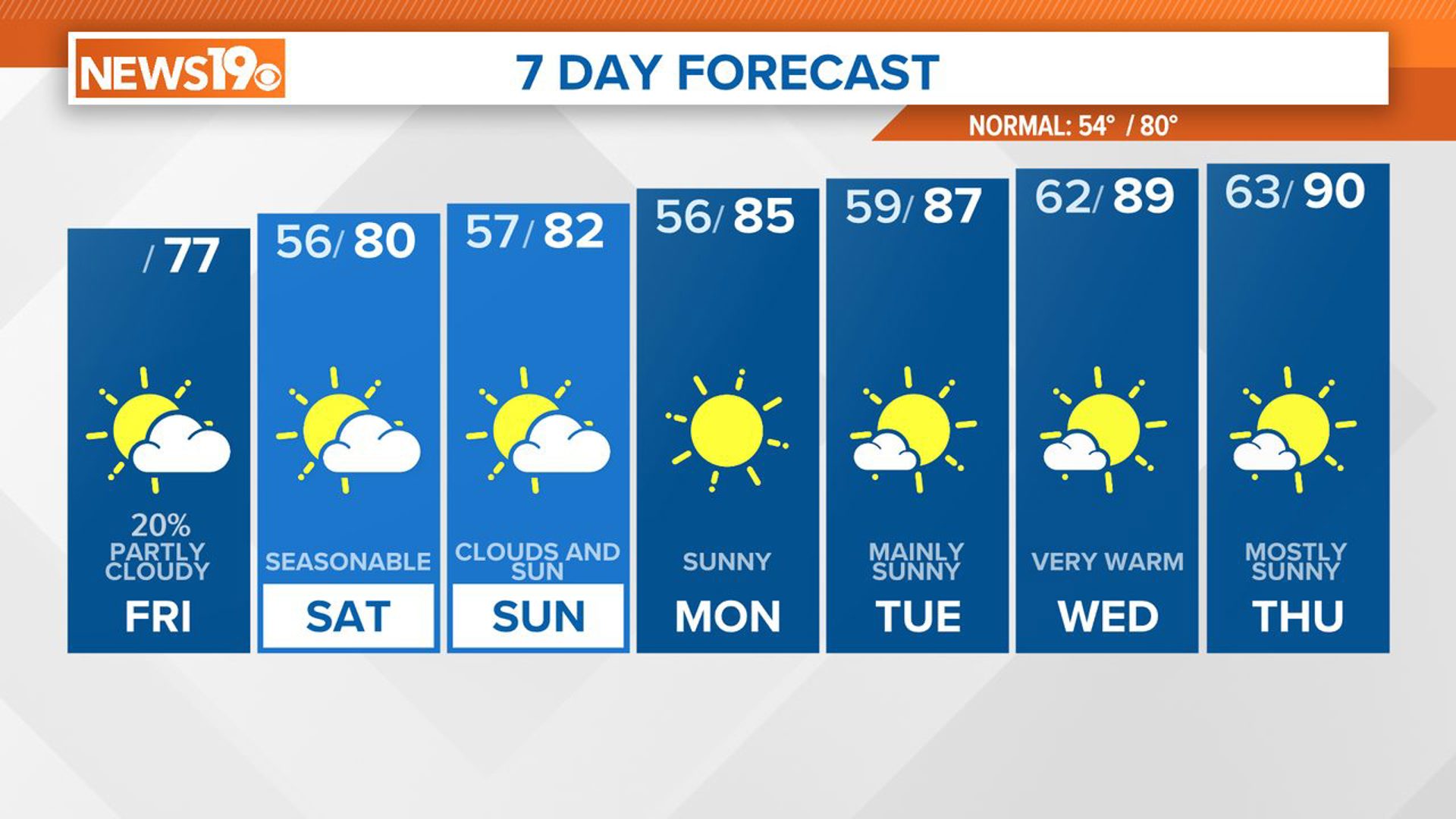
Heavy rainfall will be possible through the overnight hours. The rain chances will continue to stick around Saturday.
There may be a little break in the rain Saturday afternoon. The showers will return later in the day. Heavy rain is expected Saturday night into early Sunday.
High temperatures may climb into the lower 70s before the showers return to the Midlands.
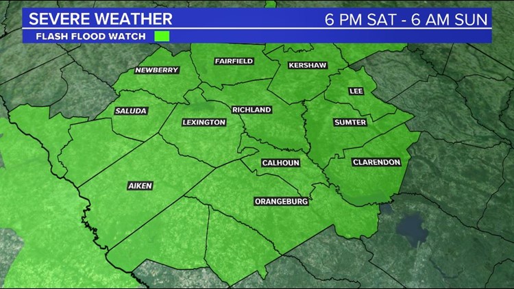
The Midlands is under a flash flood watch from Saturday at 6 PM through Sunday at 6 AM. Heavy rainfall will impact the area late Saturday afternoon through early Sunday morning.

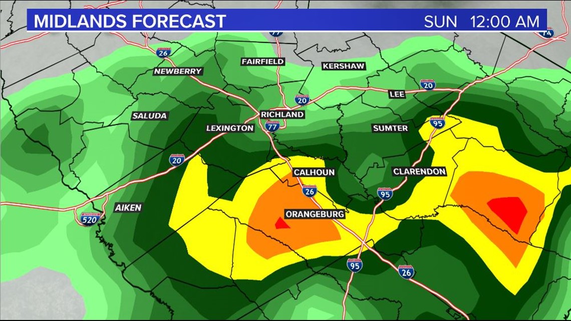
Many areas are already saturated from the recent rainfall. More showers could cause some flooding problems. Additional rainfall amounts will range from 1 to 2” with locally higher amounts. Streams and creeks may rise and that could cause some flash flooding.
The rain chances will decrease during the afternoon hours of Sunday. The first workweek of 2021 should be mainly dry.
The next best chance for rain comes late Thursday and Friday.
RELATED: Local Forecast